
Unbudgeted dirt found across a 75-lot development.
The process
The same four steps on every visit, so every report compares to the last.
- 01
Site visits
Flights on a set interval: weekly, biweekly, monthly, or at milestones, scheduled around site activity.
- 02
Fly the plan
Boundary and flight settings are saved once and re-flown on every visit, so each capture covers the site the same way.
- 03
Process
Imagery is reconstructed into an orthomosaic, surface model, and 3D data, then checked and measured.
- 04
Report
A dated Site Intelligence Report and the project files go to your shared Drive folder, ready for a pay application or meeting packet.
Flight by flight
Drag through the flights.
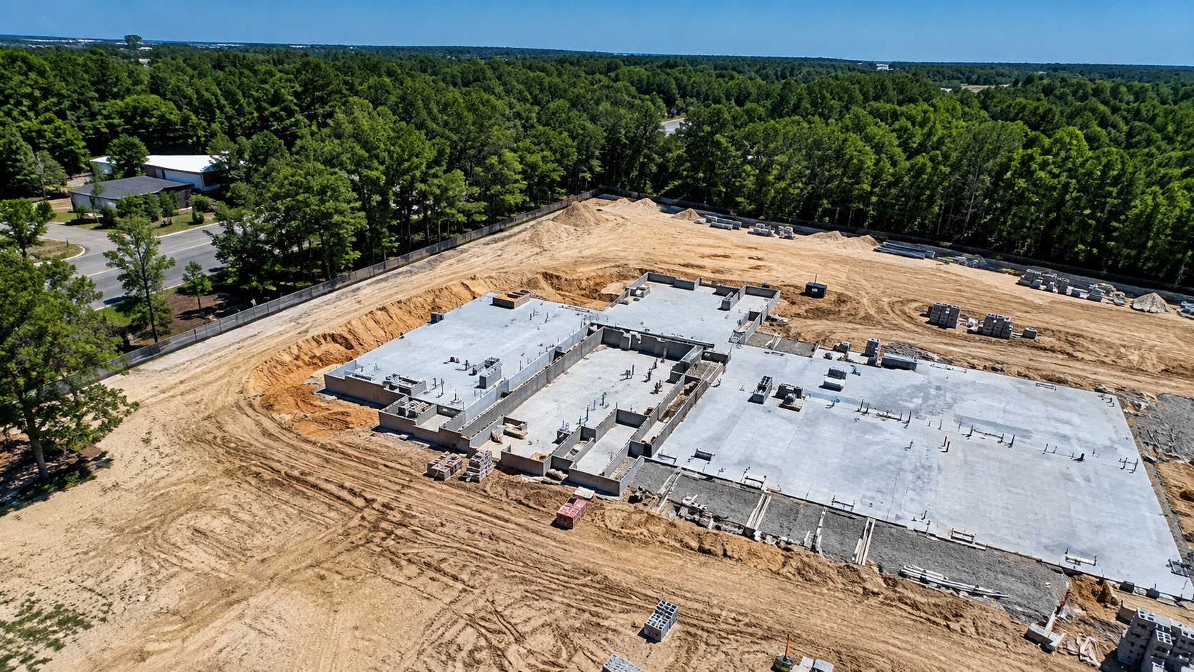
Six of the site's flights, captured on the same plan from clearing to slab. Drag the bar or tap a date.
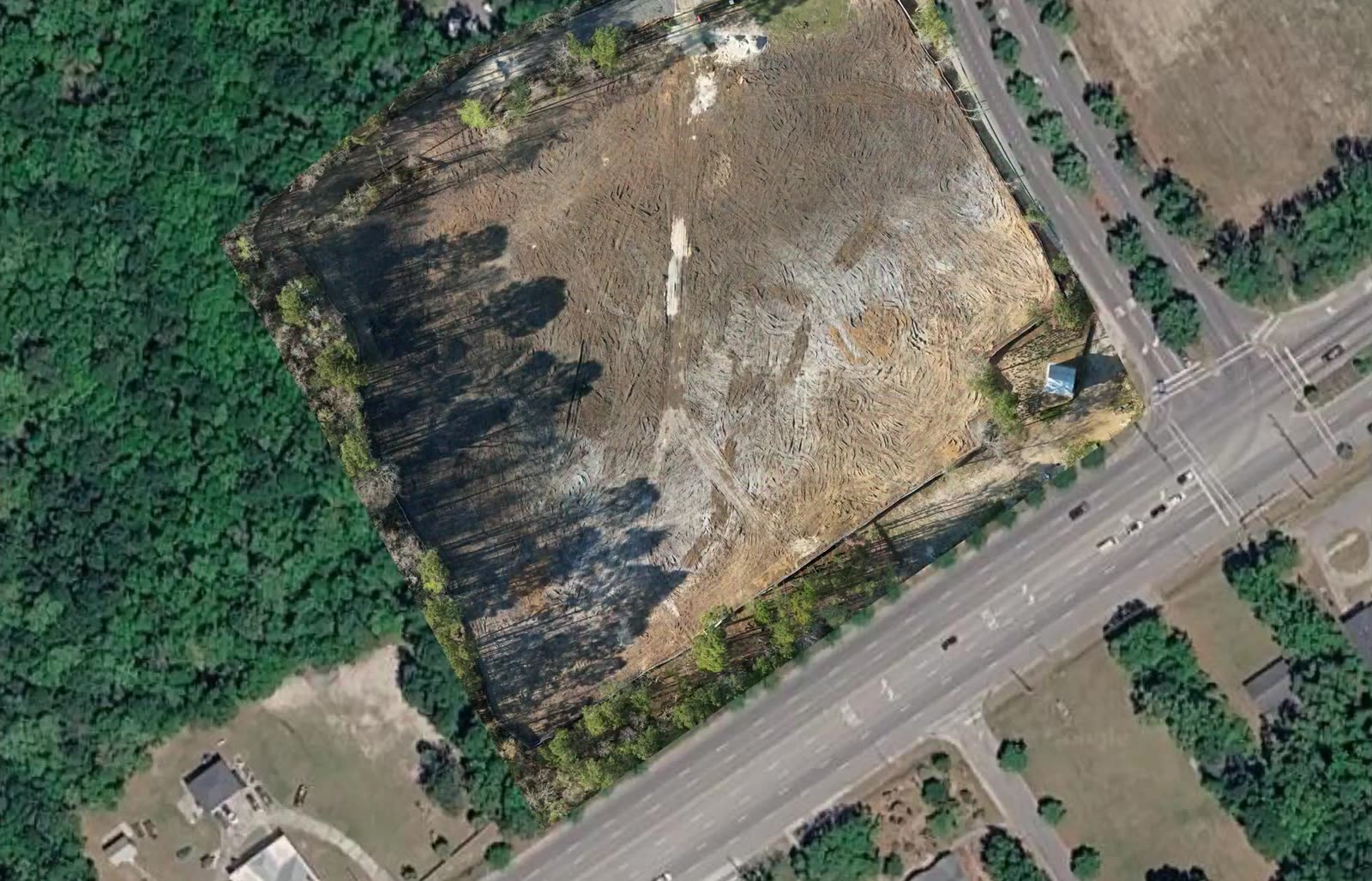
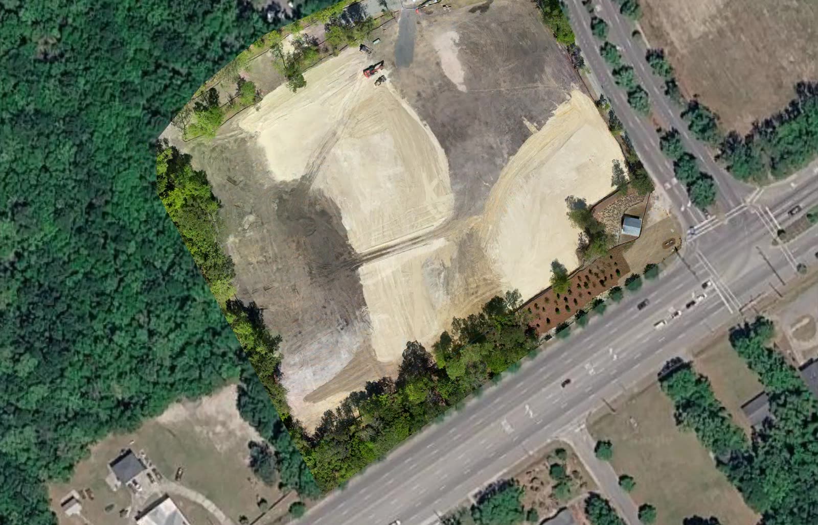
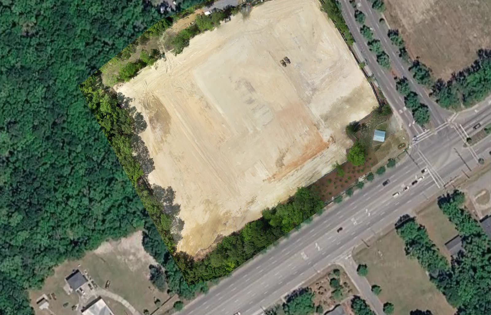
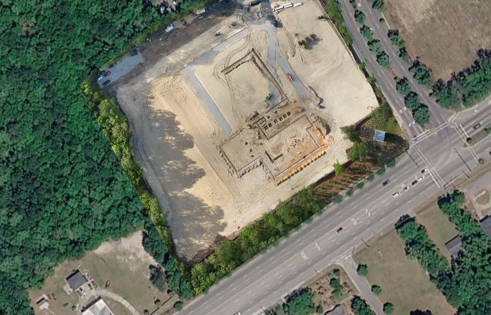
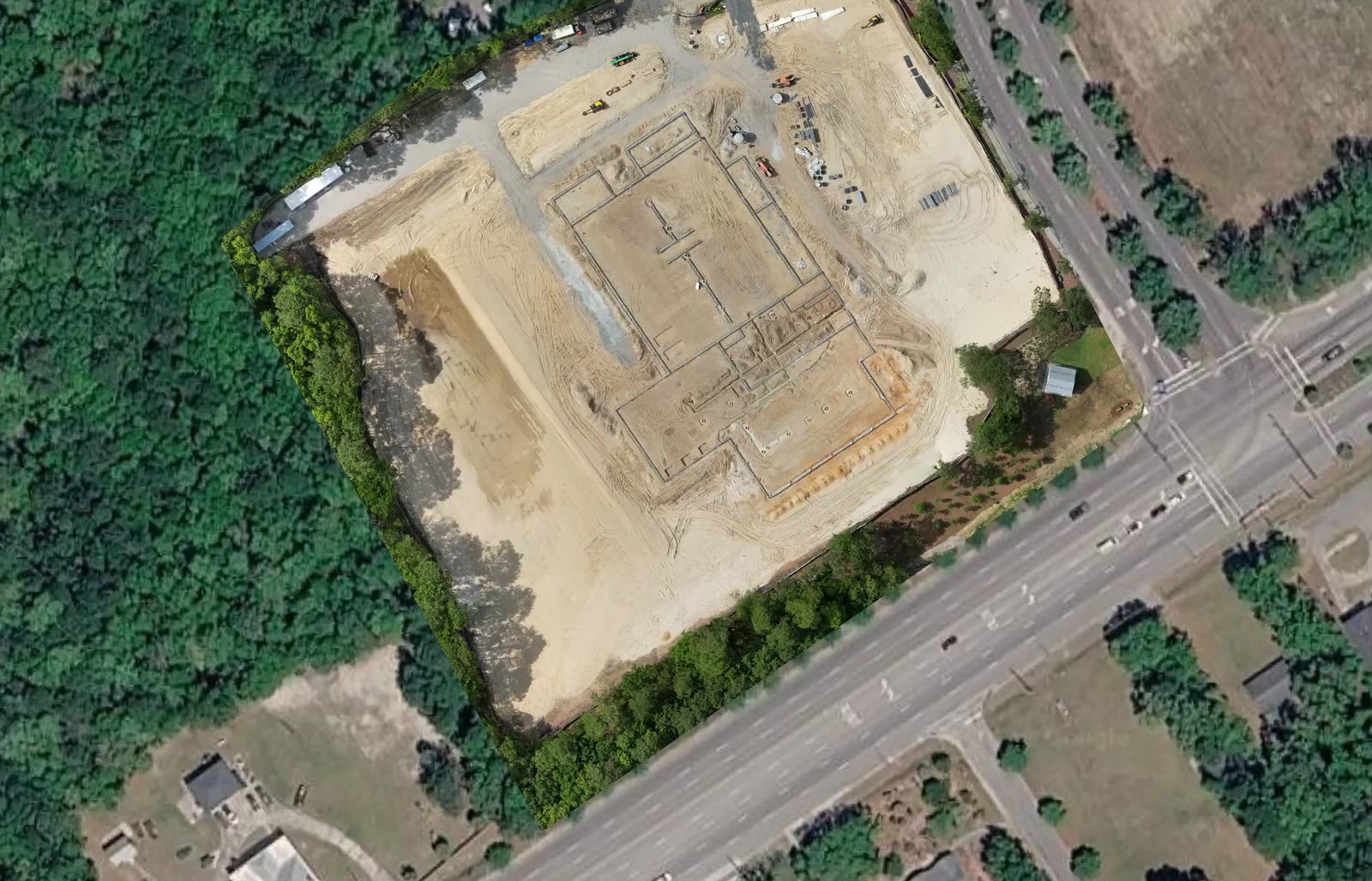
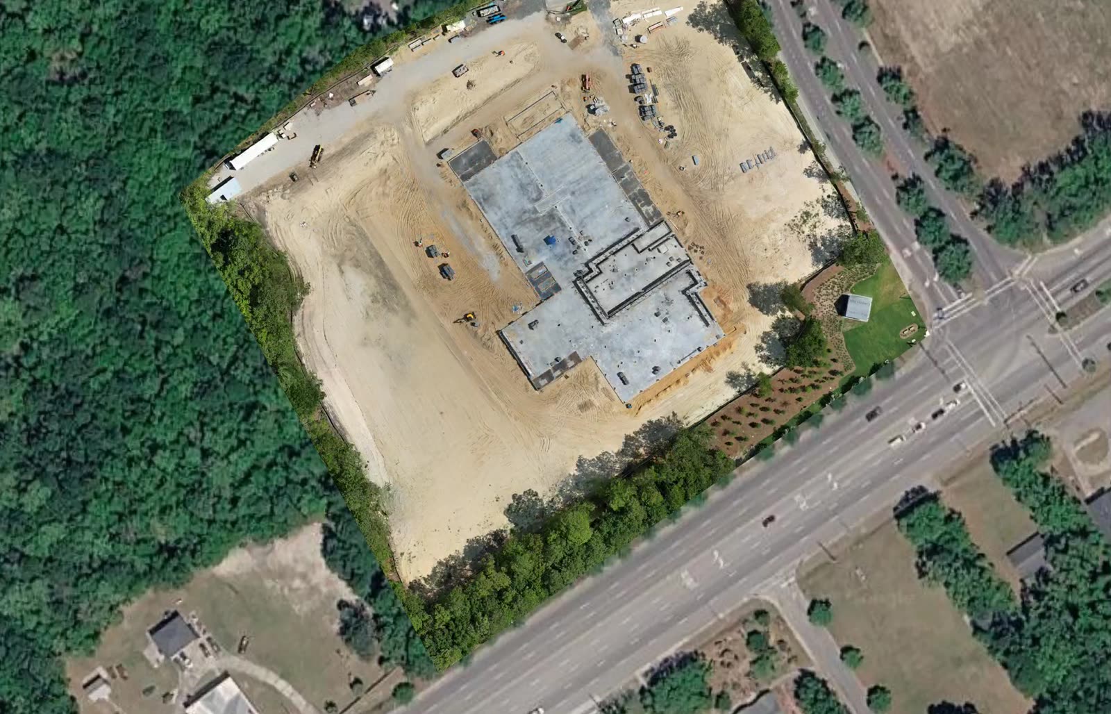 07/03/2026
What a report contains
One visit, one dated record.
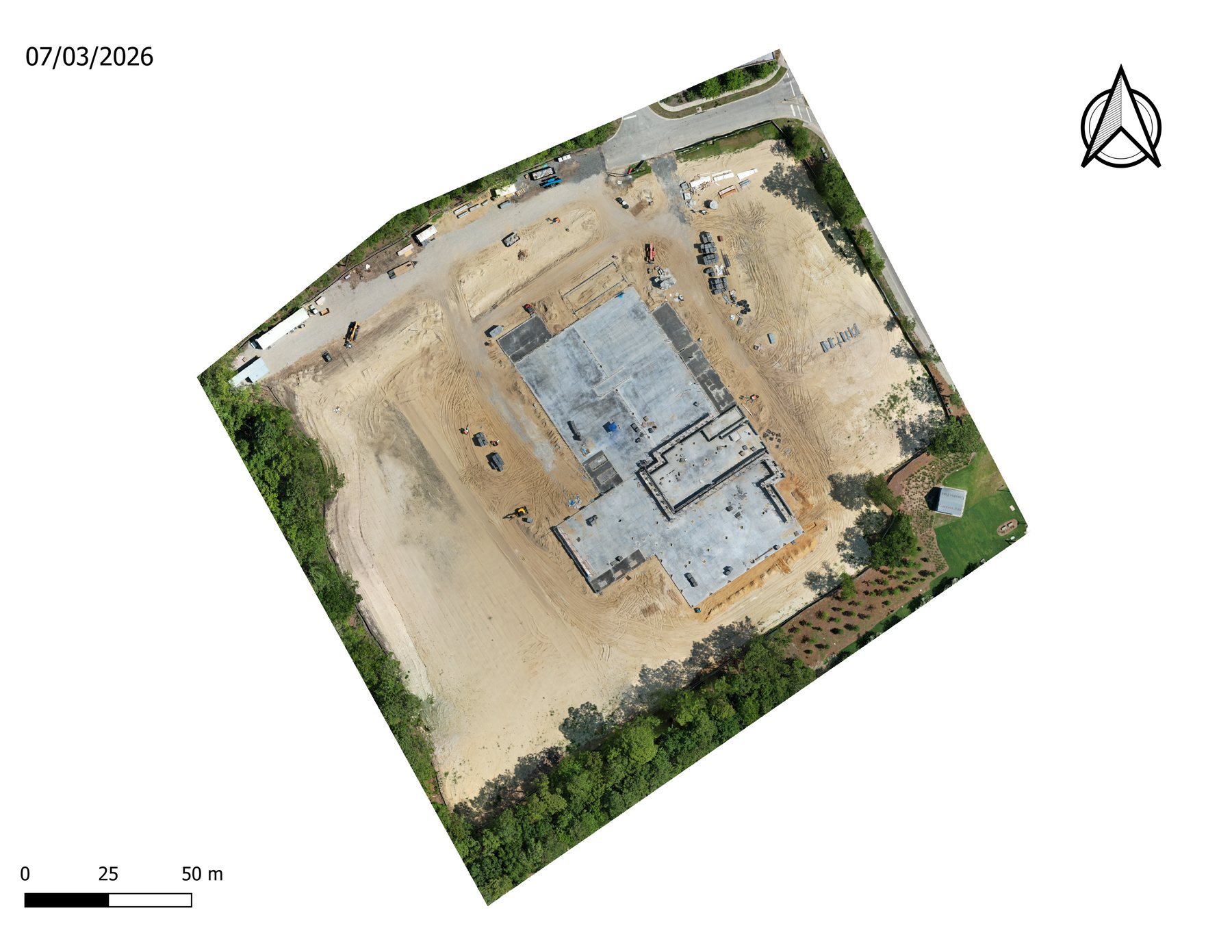
- OrthomosaicA measurable, map-accurate image of the whole site, compared against every earlier flight.
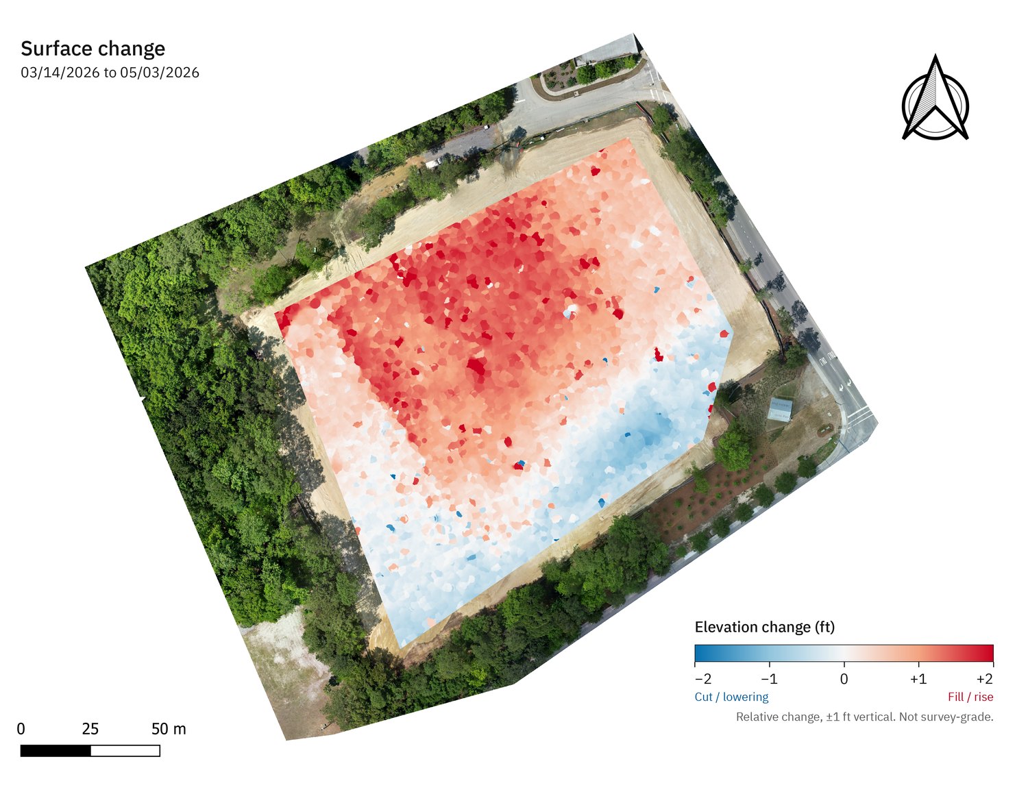
- Elevation changeA heatmap of where the ground rose and fell since the last visit, with cut and fill quantities.
- Progress photosA gallery of aerial stills of the work in place on the day of the flight.
- Oblique aerialsAngled views of structures, slabs, and walls that a top-down map can't show.
- Time-lapseEvery flight stitched into one continuous view of the site taking shape.
Time-lapse
Watch the site take shape.
Every flight follows the same plan, so the captures line up into one continuous time-lapse of the site.
What this shows a GC
One flight, three answers.
Where are we?
The orthomosaic shows current site conditions at a measurable scale.
How much moved?
The surface model is the baseline for cut/fill and stockpile volumes on the next flight.
Who needs to know?
The report packages it for OAC meetings and owner updates without anyone opening GIS software.
File formats
Files your team already knows how to open.
| Deliverable | Format | Typical use |
|---|---|---|
| Orthomosaic | GeoTIFF · KMZ | Measuring, overlaying CAD and site plans, GIS and web map review |
| Digital surface / terrain model | GeoTIFF (DSM / DTM) | Grades, drainage review, volume calculations |
| Point cloud | LAS / LAZ | Existing conditions and design checks in your CAD software |
| 3D model | OBJ · GLB | Existing conditions, design review, stakeholder presentations |
| Contours | DXF · SHP | Design comparison, existing conditions |
| Design-versus-built overlay | PDF · KMZ | Checking layout, grades, and progress against the design |
| Site Intelligence Report | OAC meetings, lender draws, owner updates |
Where the money goes
The costs a dated site record helps you control.
Find the breached fence this week, not on the county's notice.
In Charleston County, a stormwater deficiency must be corrected within 3 working days of a notice of violation, followed by a stop-work order and/or $1,000 per day for each deficiency. South Carolina law allows civil penalties up to $10,000 per day of violation. The state construction stormwater permit requires inspections every week, no more than 9 days apart.
Charleston County Stormwater Program · SC Code § 48-1-330 · SC DES Construction General PermitCatch a grade error before the next trade builds on top of it.
A 2026 study measured rework at 0.38% of contract value before completion and 0.76% including post-completion work, reaching 7.34% on single projects. The same study found rework under-reported by 300%.
Love et al., ASCE Journal of Construction Engineering and Management, 2026Know where your dirt went before the trucking invoice arrives.
Borrow excavation on a recent SCDOT contract was priced at $48.00 to $86.40 per cubic yard.
SCDOT Contract 4074030, October 2025Record every pipe and conduit while the trench is still open.
Damage to buried utilities costs about $30 billion a year. Federal research found $4.62 saved for every $1 spent locating utilities before construction.
Common Ground Alliance · FHWA / Purdue University, 2000Give your lender a dated, site-wide record of work in place with every draw.
Every report shows the whole site on a known date, so draw reviews start from the same picture.
Document your site before the storm and again after it.
A flight before a named storm and one after it give you a dated comparison of site conditions.
Industry examples
What recurring site documentation has caught for other contractors.
A conduit in the wrong location and depth was caught on a routine flight, before the plumbing sub laid an 8-inch pipe. No schedule impact.
Missing stone found through daily progress flights, before it became a payment dispute.
Map your site the same way.
Send the address and what you need to know. You'll get a scope and a flight date back.